African wildlife
Products & Tools

The BOESA Product Suite

BOESA is a growing family of products, tools and services built by RCMRD to put geospatial intelligence to work for conservation across Eastern and Southern Africa. Explore the platforms below.

Flagship Product · Geospatial Intelligence

Interactive Biodiversity Dashboard

Our flagship interactive product: explore live spatial data on protected areas, ecosystems and biodiversity indicators across the region. Filter to uncover the story in the data.

Open Dashboard in Full Screen ↗

</> AI-Powered · Data Quality

WDPCA Validator

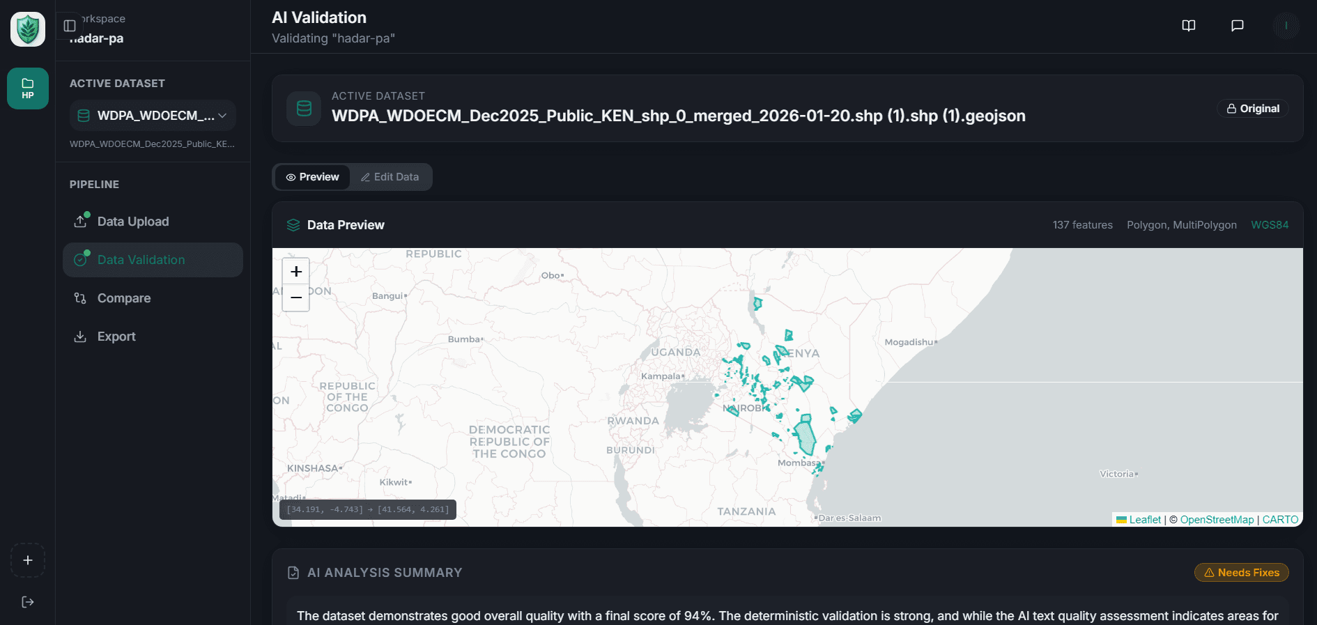
Submitting protected and conserved area data to Protected Planet demands exacting GIS standards which is a barrier for many of the people who hold the data. The WDPCA Validator closes that gap.

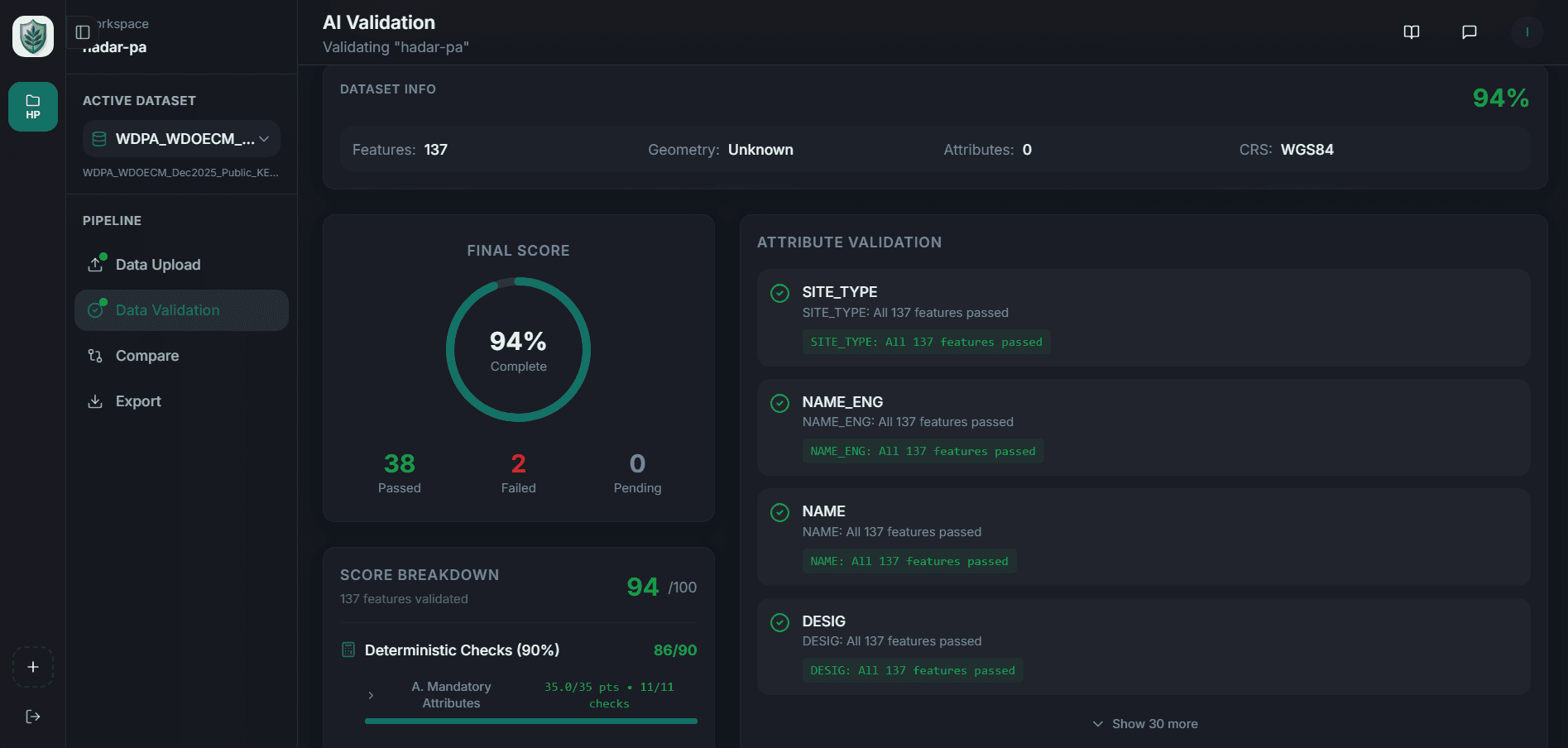
It is an intelligent workspace that ingests your dataset, checks it against the WDPCA standard, scores it, and pinpoints exactly what to fix then exports a submission ready file. Anyone can submit with confidence, no deep GIS expertise required.

Automated, rule-based validation against the WDPCA schema
AI analysis, quality scoring & targeted fix suggestions
One-click, Protected Planet–ready export
Start Validating →
wdpca-validator.rcmrd.org
WDPCA Validator workspace — dataset preview on an interactive map
wdpca-validator.rcmrd.org
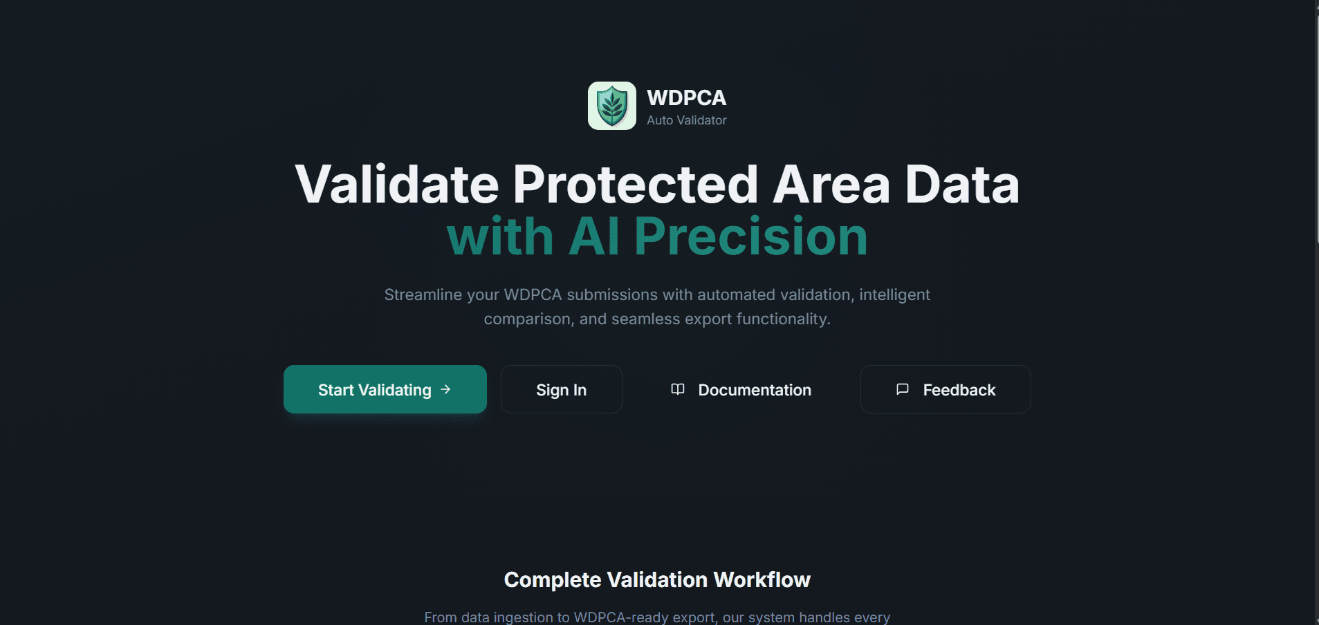
WDPCA Validator landing screen
wdpca-validator.rcmrd.org
WDPCA Validator AI analysis and scoring dashboard

</> KMGBF · Capacity Building

KMGBF CNA Tool

The KMGBF Capacity Needs Assessment (CNA) Tool is a web-based platform designed to help institutions assess, track, and plan for capacity development in support of the Kunming-Montreal Global Biodiversity Framework (KMGBF).

The tool enables structured self-assessment across eight capacity dimensions and 23 biodiversity targets, turning that self-assessment into a live readiness dashboard your institution can act on.
Structured self-assessment across 8 capacity dimensions
Progress tracking against all 23 KMGBF biodiversity targets
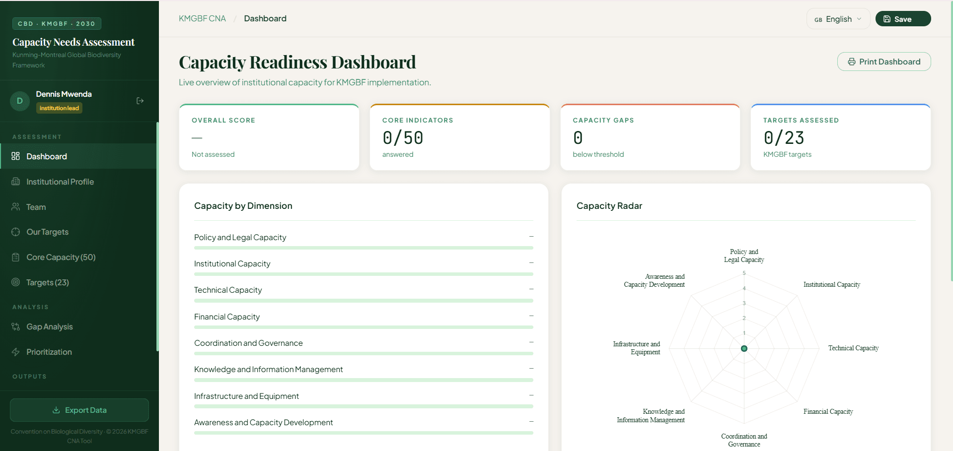
Live capacity-readiness dashboard with gap analysis & radar view
Start Your Assessment →
cnatool.live
KMGBF CNA Tool — Capacity Readiness Dashboard with radar chart and dimension scores
cnatool.live
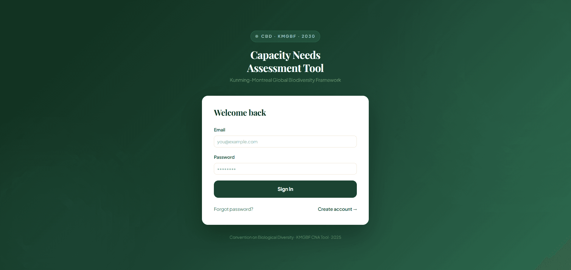
KMGBF CNA Tool — sign-in screen

Explore the Ecosystem

The Full Product Suite

A growing family of platforms and resources — from data and maps to trainings, storytelling and community. Explore each one.

BOESA

BOESA

The flagship regional biodiversity outlook publication.

Community

Community

Connect, share and engage with the conservation community.

Explore →
Trainings

Trainings

Hands on GIS and geospatial storytelling courses.

Explore →
Multimedia

Multimedia

Videos, stories and visual media from across the region.

Explore →
Geoportal

Geoportal

The central hub for RCoE geospatial data and services.

Explore →
Geo Hex

Geo Hex

Hex grid conservation challenges and visualisations.

Explore →
Policy Briefs

Policy Briefs

Concise, evidence-based briefs for decision-makers.

Explore →
Sport

Sport

Sport for conservation, health and community wellbeing.

Arts & Maps

Arts & Maps

Arts and maps competition for schools and young adults.

Explore →
Map Book

Map Book

A curated atlas of maps across Eastern & Southern Africa.

Explore →
Comic Book

Comic Book

Illustrated adventures that make nature fun to learn.

WDPCA Validator

WDPCA Validator

Validate protected-area datasets against the WDPCA schema.

Explore →